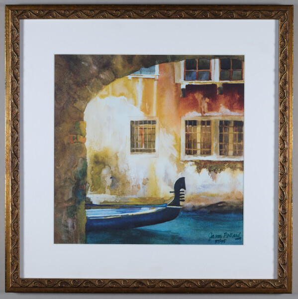
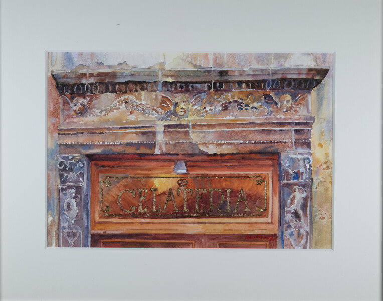
Eleanor met Jann Pollard in San Mateo, CA, in the 1970's when Jann and her family moved across the street. This piece is titled "Venice Textures." The original was painted in watercolor. Jann published 95 archival limited edition IRIS giclee prints on Arches Cold Press paper. Each print was inspected and signed by Jann. This is print number 37/95.
Eleanor bought this watercolor from Jann directly. Jann's subtle use and wide range of color (from purple to yellow to blue) creates a cool, realistic and inviting scene in nature.
Image 20 of 47
| Image: 5275 | Size: 8558x12294px
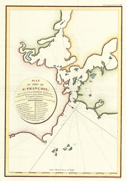
E205 - San Francisco - La Perousse - 1798 - M5744
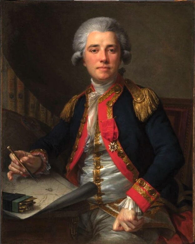
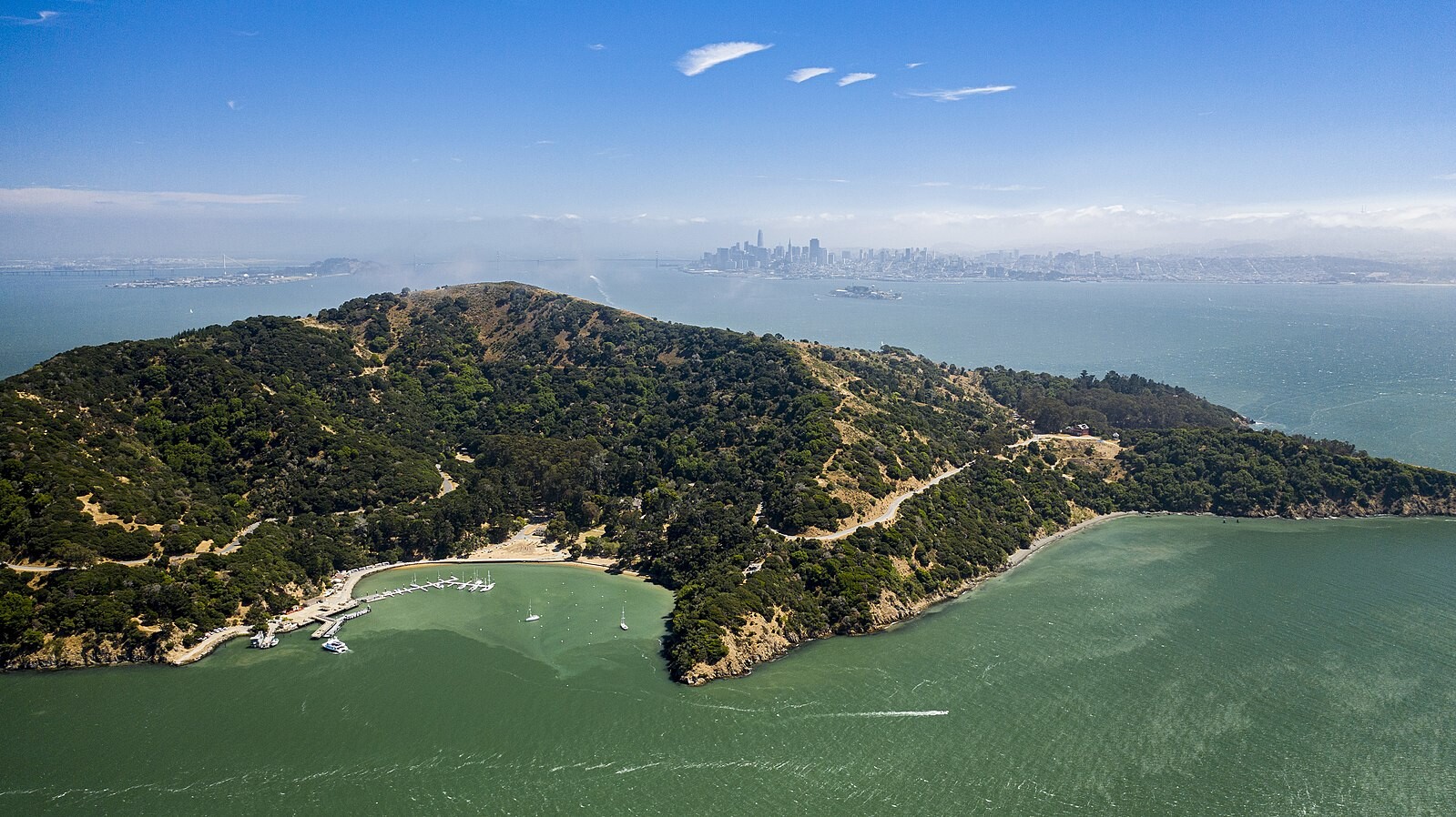
“This is the earliest obtainable map of San Francisco Bay. The map may seem a little hard to decipher by modern standards. It is oriented to the Northeast, the peninsula emerging from the right is the location of the modern urban center of modern Francisco, with the Golden Gate being the tiny entrance into he larger bay. The general form of San Pablo Bay, which leads into Suisun Bay is evident at the top of the map. The greater part of San Francisco Bay, extending towards the right side of the map is significantly truncated. The map identifies 21 place names, including Alcatraz, the Presidio, Merced, the Mission of San Francisco, and other landmarks, alphanumerically via a table integrated into the title cartouche...La Perouse did not personally survey the Bay, instead he most likely obtained the data for this map from the Spanish pilot Francisco Antonio Mourelle de la Rúa (1750-1820) in Manilla...La Perouse died tragically on a shipwreck near the Solomon Islands. His journals were shipped back to Europe from Australia before the shipwreck and posthumously published in 1797, along with an accompanying atlas volume, from which this map was drawn, Atlas du voyage de La Perouse.” geographicus.com
Image 22 of 47
| Image: 5273 | Size: 14124x10800px
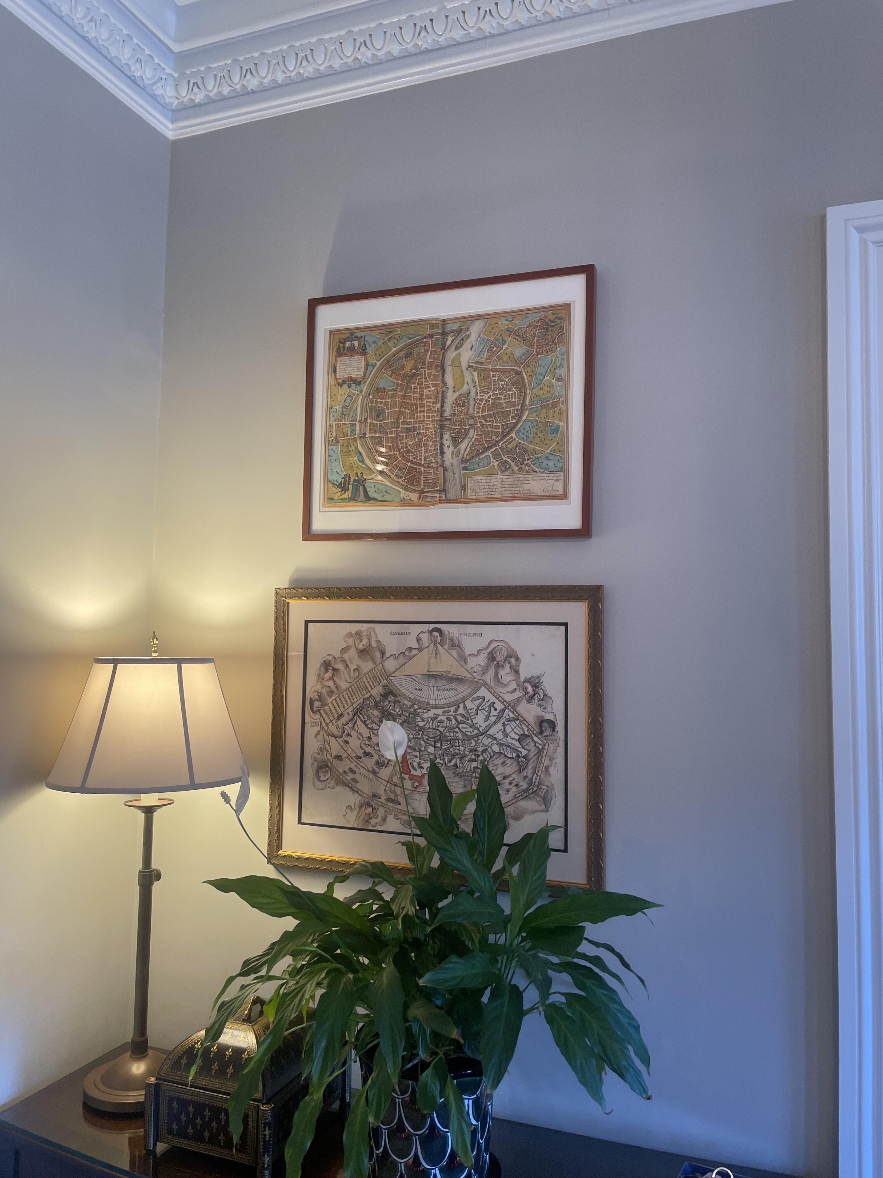
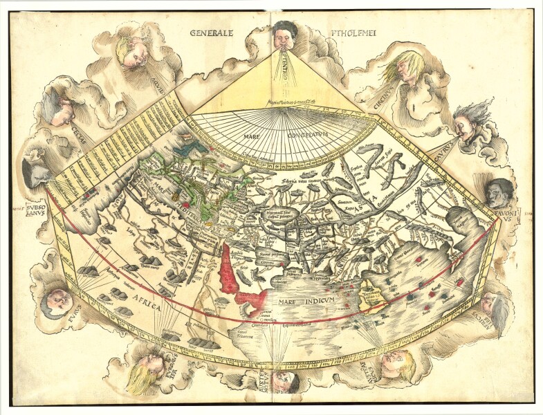
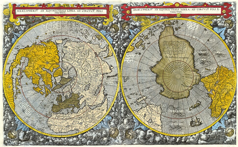
E205 - The World - Martin Waldseemueller - 1513 - M5742
Striking example of Waldseemüller 's Ptolemaic world map, from the important 1513 Strasbourg edition of Ptolemy's Geographia. In his landmark catalog of world maps, Rodney Shirley called this map "one of the most attractive Ptolemaic maps ever produced” (Shirley, map 34).
The Strasbourg edition is widely considered the most important edition of Ptolemy's Geographia. The whirling wings surround the world as it was known to Ptolemy, the oikumene. The basic cartography of the map follows Ptolemy, although Waldseemüller does open up the Indian Ocean in the East and also eliminates the land to the south of the Indian Ocean which appeared in earlier maps. There is a very early use of longitude and latitude lines, along with notes on the climates in the left margin beyond the map.
Waldseemüller likely began work on the Geographia map in ca. 1505, when he was a professor of cosmography in St.-Dié. Waldseemüller worked on the Ptolemy with Matthias Ringmann, who collated the texts, while Waldseemüller compiled the maps. However, when their patron René II died in 1508, the St.-Dié Press closed down. Ringmann died in 1511. These events stalled the project and it was only in 1513 that the Ptolemy appeared, printed by Waldseemüller’s friend Johann Schott. Raremaps.com
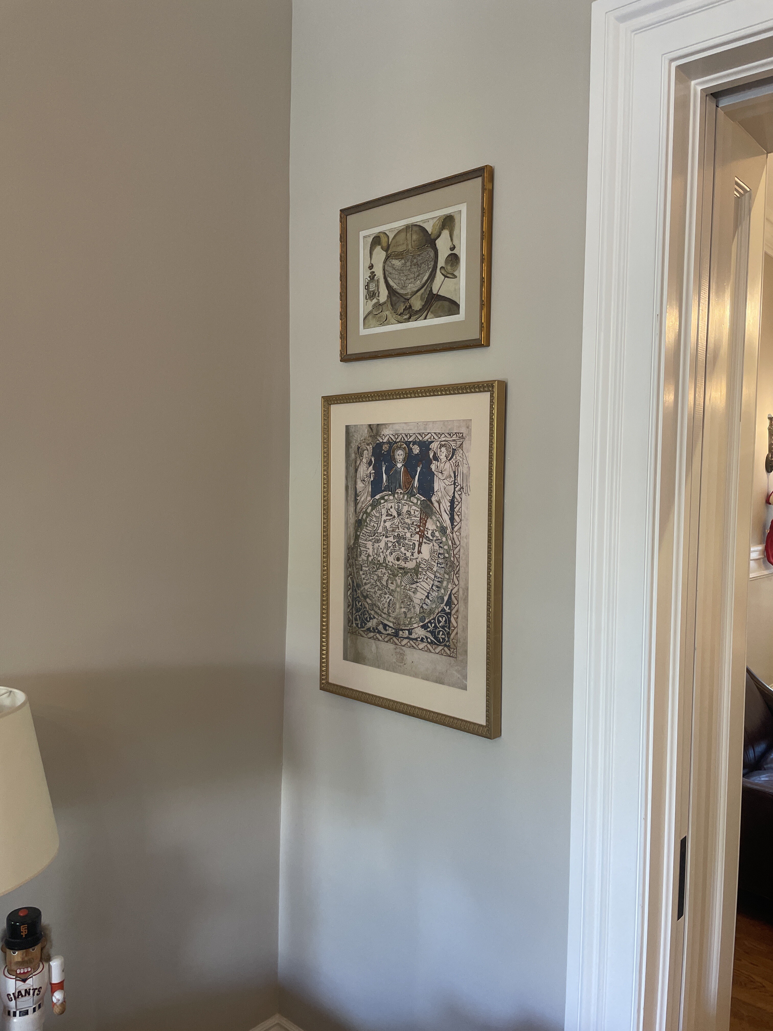
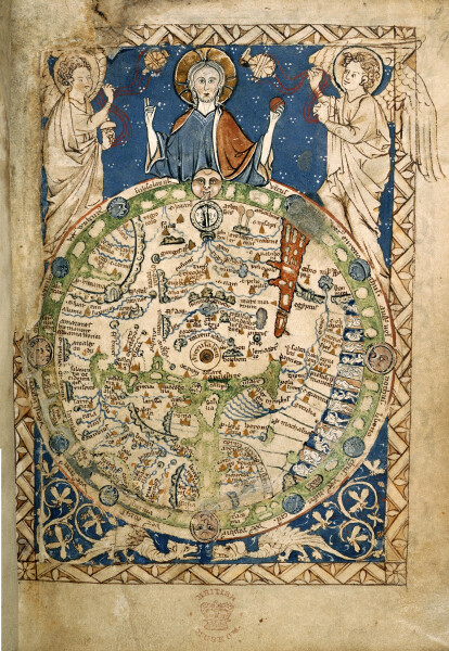
“The Psalter map is an English map from the thirteenth century that includes much information within it's small area Like many medieval maps, this world map subjectively presents Jerusalem, as enlarged and at the center, as Jesus overlooks the world. The map also contains many indicators of the materiality of the Middle Ages, including buildings, boats, "monstrous" human races (along the right-hand side) and the wind. Thus, the map acts as a record of how people experienced the world during this time period.” History Fine Prints (on etsy)
“Psalter World Map is the name historiography gave to a medieval world map that has been found in a psalter. This mappa mundi is now conserved at the British Library in London. The small map (c. 9.5 cm or 3.7 in high) shows a lot of detail. It was written around 1260; the author is unknown. According to historian Anna-Dorothee von den Brincken, it looks like a small version of the Ebstorf Map from Northern Germany. It is a typical mappa mundi that does not only show the geographical and historical knowledge, but also puts it into the frame of salvation history. Jesus Christ appears in the East (i.e. "above"), as the maps of Christian Middle Ages have East above, not North, giving a blessing with his right hand.” wikipedia
“A psalter is a volume containing the Book of Psalms, often with other devotional material bound in as well, such as a liturgical calendar and litany of the Saints. Until the later medieval emergence of the book of hours, psalters were the books most widely owned by wealthy lay persons and were commonly used for learning to read. Many Psalters were richly illuminated and they include some of the most spectacular surviving examples of medieval book art.” wikipedia
Image 26 of 47
| Image: 5276 | Size: 14933x10103px
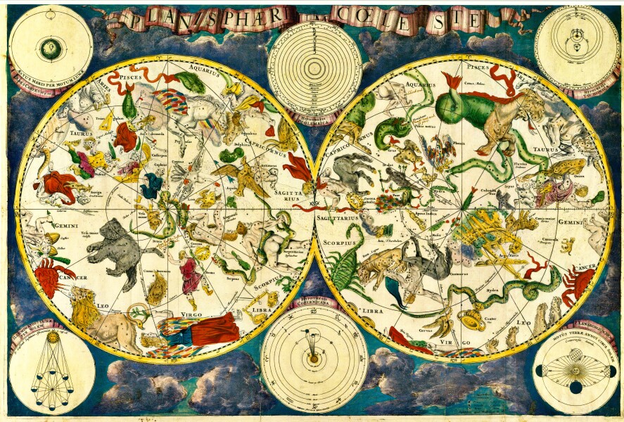
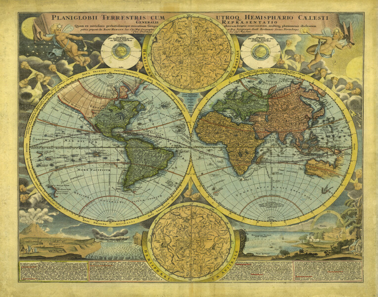
E205 - Celestial Planisphere - Frederick de Wit - 1680 - M5746
”Planisphaeri coeleste, 1680, a celestial planisphere featuring the constellations of the northern and southern hemispheres with traditional representations of the signs of the Zodiac and constellations, including Draco, Serpens and Hydra. Astronomy and celestial star chart map by the Dutch cartographer family Frederik de Wit. A star chart or star map is a map of the night sky. Astronomers divide these into grids to use them more easily. They are used to identify and locate astronomical objects such as stars, constellations and galaxies. They have been used for human navigation since time immemorial. A planisphere is a type of star chart. The Atlas Coelestis is a star atlas published posthumously in 1729, based on observations made by the First Astronomer Royal, John Flamsteed.” alamy.com
Image 27 of 47
| Image: 5287 | Size: 9449x7293px
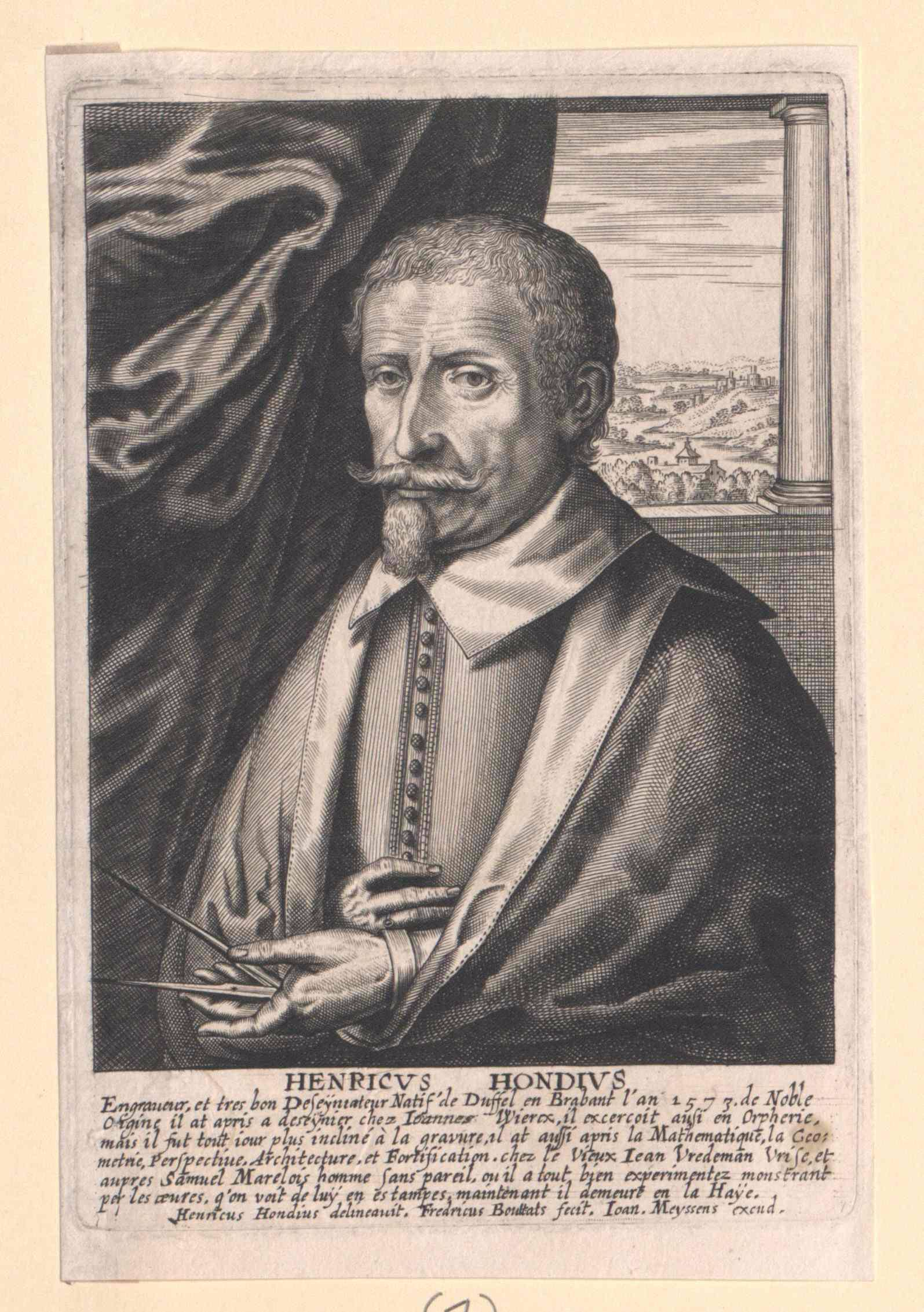
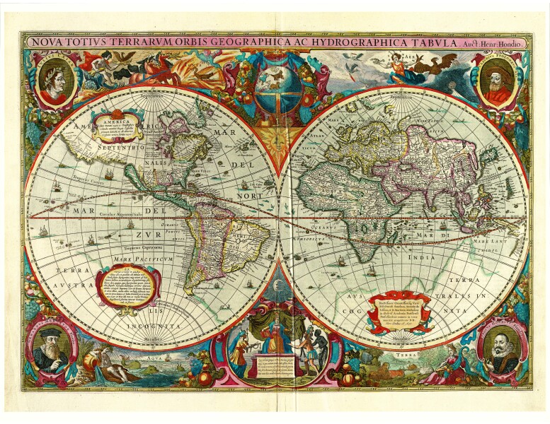
E205 - The World by Hondius - 1630 - M5860
Hendrik Hondius (1573 - 1650) was a Dutch Golden Age engraver, cartographer and publisher. This wonderful and very detailed map was first published around 1630, in his famous atlas Atlantis Maioris. It was the first dated map published in an atlas, and therefore the first widely available map, to show any part of Australia. The map is within decorative border, with portraits of Julius Caesar, Ptolomey, Gerhard Mercator and Jodocus Hondius and tableaus depicting the 4 elements - Earth, Air, Fire and Water. Terra Incognita Maps
Nova Totius Terrarum Orbis Geographica ac Hydrographica Tabula is a map of the world created by Hendrik Hondius in 1630, and published the following year at Amsterdam, in the atlas Atlantis Maioris Appendix. Illustrations of the four elements of fire, air, water, and land are included. In the four corners, there are portraits of Julius Caesar, Claudius Ptolemy, and the atlas's first two publishers, Gerard Mercator and Jodocus Hondius, the father of Hendrik.[39] Among its claims to notability is the fact that it was the first dated map published in an atlas, and therefore the first widely available map, to show any part of Australia, the only previous map to do so being Hessel Gerritsz' 1627 Caert van't Landt van d'Eendracht ("Chart of the Land of Eendracht"), which was not widely distributed or recognised. The Australian coastline shown is part of the west coast of Cape York Peninsula, discovered by Jan Carstensz in 1623. Curiously, the map does not show the west coast features shown in Gerritsz' Caert. Wikipedia
Image 36 of 47
| Image: 5285 | Size: 7054x2878px
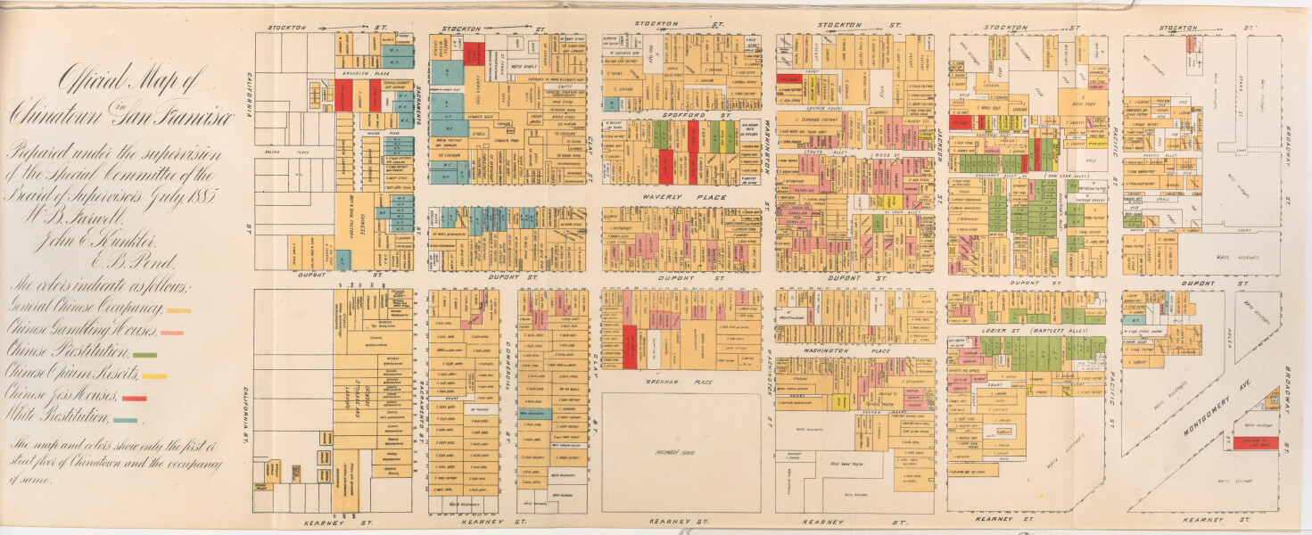
E205 - San Francisco Chinatown, by Board of Supervisors, Farwell, Kunkler & Pond, 1885 - M5858
“This map reflects the pervasive bias against the Chinese in California and in turn further fostered the hysteria. It was published as part of an official report of a Special Committee established by the San Francisco Board of Supervisors "on the Condition of the Chinese Quarter." The Report resulted from a dramatic increase in hostility to the Chinese, particularly because many Chinese laborers had been driven out of other Western states by vigilantes and sought safety in San Francisco...From the report: "The Chinese brought here with them and have successfully maintained and perpetuated the grossest habits of bestiality practiced by the human race." The map highlights the Committee's points, particularly the pervasiveness of gambling, prostitution and opium use. The Report concludes with a recommendation that the Chinese be driven out of the City by stern enforcement of the law.” PJ Mode Collection at Cornell
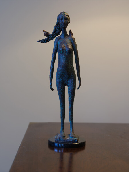
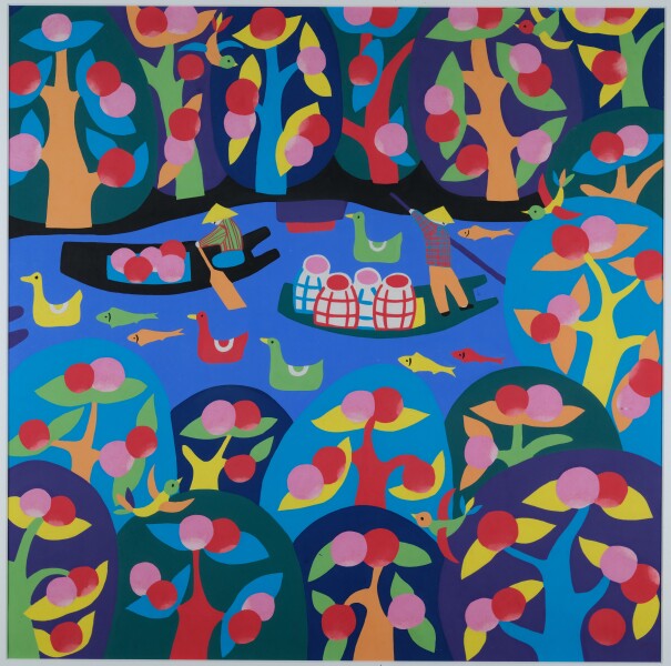
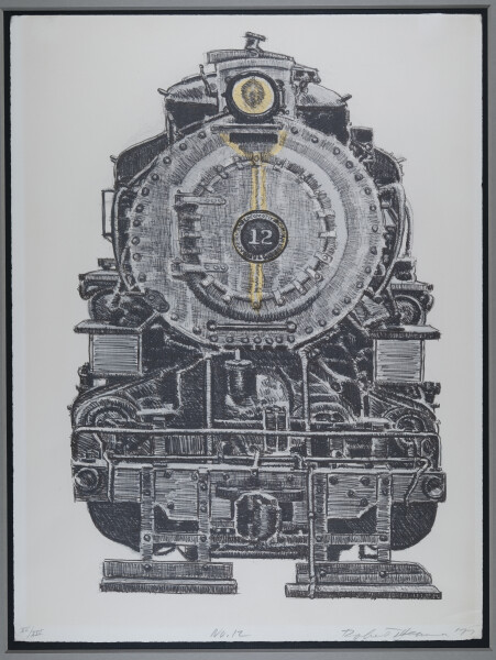
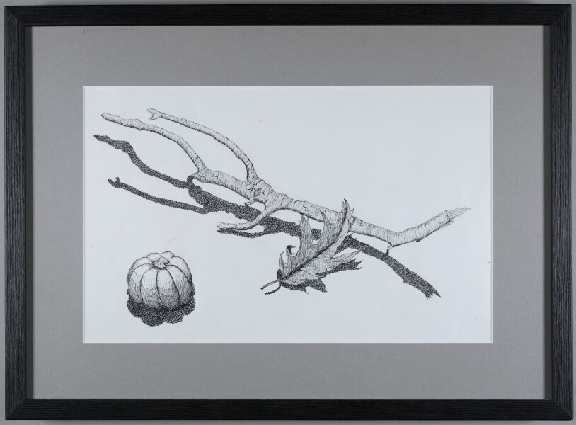
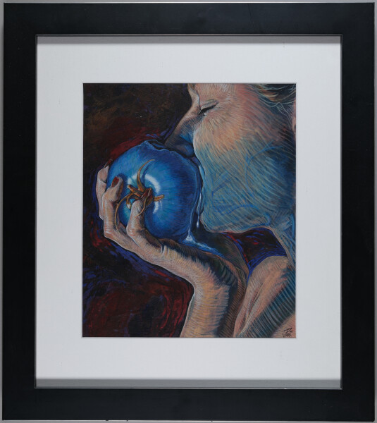
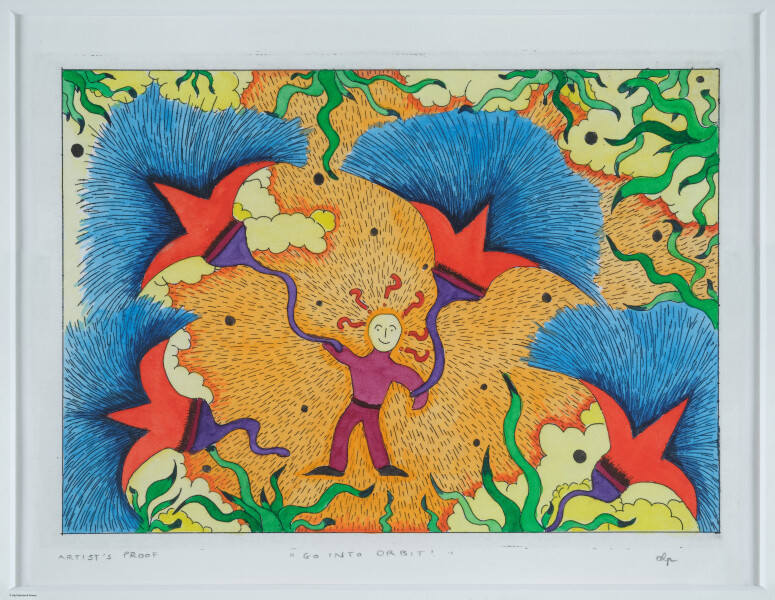
Eleanor and Tom met Jon Parr through his wife, Marin Thurber. We attended his California College of the Arts graduation exhibit in 2001 and bought this piece which we thought was his best work. We call it "eating genetically modified fruit." Marin was his model for this piece. Jon now lives in LA with his family and is a commercial artist.
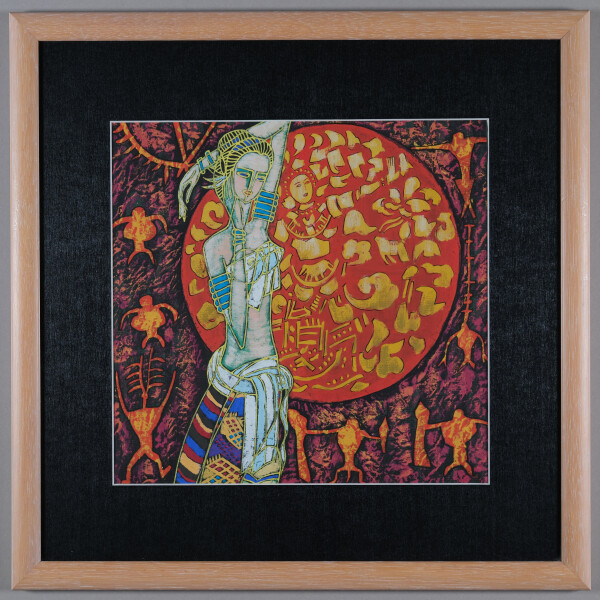
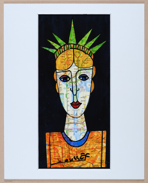
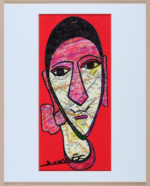
We bought this piece of art in November 2023 at an exhibition of lilies work that was held at the birdcage in San Francisco a gallery at the corner of Sutter and Jones. I think. It is across the street from where Steve Bazant used to live. I love the intensity of the image. And despite the over anger, the bunny years tell me that it’s OK or maybe a better way to say it is that the bunny ears balance the anger.
I also thought it’s fun and a little ironic that I placed this work in between my children’s bedrooms.
Eleanor met Jann Pollard in San Mateo, CA, in the 1970's when Jann and her family moved across the street. This piece is titled "Venice Textures." The original was painted in watercolor. Jann published 95 archival limited edition IRIS giclee prints on Arches Cold Press paper. Each print was inspected and signed by Jann. This is print number 37/95.
Eleanor bought this watercolor from Jann directly. Jann's subtle use and wide range of color (from purple to yellow to blue) creates a cool, realistic and inviting scene in nature.
“This is the earliest obtainable map of San Francisco Bay. The map may seem a little hard to decipher by modern standards. It is oriented to the Northeast, the peninsula emerging from the right is the location of the modern urban center of modern Francisco, with the Golden Gate being the tiny entrance into he larger bay. The general form of San Pablo Bay, which leads into Suisun Bay is evident at the top of the map. The greater part of San Francisco Bay, extending towards the right side of the map is significantly truncated. The map identifies 21 place names, including Alcatraz, the Presidio, Merced, the Mission of San Francisco, and other landmarks, alphanumerically via a table integrated into the title cartouche...La Perouse did not personally survey the Bay, instead he most likely obtained the data for this map from the Spanish pilot Francisco Antonio Mourelle de la Rúa (1750-1820) in Manilla...La Perouse died tragically on a shipwreck near the Solomon Islands. His journals were shipped back to Europe from Australia before the shipwreck and posthumously published in 1797, along with an accompanying atlas volume, from which this map was drawn, Atlas du voyage de La Perouse.” geographicus.com
E205 - The World - Martin Waldseemueller - 1513 - M5742
Striking example of Waldseemüller 's Ptolemaic world map, from the important 1513 Strasbourg edition of Ptolemy's Geographia. In his landmark catalog of world maps, Rodney Shirley called this map "one of the most attractive Ptolemaic maps ever produced” (Shirley, map 34).
The Strasbourg edition is widely considered the most important edition of Ptolemy's Geographia. The whirling wings surround the world as it was known to Ptolemy, the oikumene. The basic cartography of the map follows Ptolemy, although Waldseemüller does open up the Indian Ocean in the East and also eliminates the land to the south of the Indian Ocean which appeared in earlier maps. There is a very early use of longitude and latitude lines, along with notes on the climates in the left margin beyond the map.
Waldseemüller likely began work on the Geographia map in ca. 1505, when he was a professor of cosmography in St.-Dié. Waldseemüller worked on the Ptolemy with Matthias Ringmann, who collated the texts, while Waldseemüller compiled the maps. However, when their patron René II died in 1508, the St.-Dié Press closed down. Ringmann died in 1511. These events stalled the project and it was only in 1513 that the Ptolemy appeared, printed by Waldseemüller’s friend Johann Schott. Raremaps.com
“The Psalter map is an English map from the thirteenth century that includes much information within it's small area Like many medieval maps, this world map subjectively presents Jerusalem, as enlarged and at the center, as Jesus overlooks the world. The map also contains many indicators of the materiality of the Middle Ages, including buildings, boats, "monstrous" human races (along the right-hand side) and the wind. Thus, the map acts as a record of how people experienced the world during this time period.” History Fine Prints (on etsy)
“Psalter World Map is the name historiography gave to a medieval world map that has been found in a psalter. This mappa mundi is now conserved at the British Library in London. The small map (c. 9.5 cm or 3.7 in high) shows a lot of detail. It was written around 1260; the author is unknown. According to historian Anna-Dorothee von den Brincken, it looks like a small version of the Ebstorf Map from Northern Germany. It is a typical mappa mundi that does not only show the geographical and historical knowledge, but also puts it into the frame of salvation history. Jesus Christ appears in the East (i.e. "above"), as the maps of Christian Middle Ages have East above, not North, giving a blessing with his right hand.” wikipedia
“A psalter is a volume containing the Book of Psalms, often with other devotional material bound in as well, such as a liturgical calendar and litany of the Saints. Until the later medieval emergence of the book of hours, psalters were the books most widely owned by wealthy lay persons and were commonly used for learning to read. Many Psalters were richly illuminated and they include some of the most spectacular surviving examples of medieval book art.” wikipedia
E205 - Celestial Planisphere - Frederick de Wit - 1680 - M5746
”Planisphaeri coeleste, 1680, a celestial planisphere featuring the constellations of the northern and southern hemispheres with traditional representations of the signs of the Zodiac and constellations, including Draco, Serpens and Hydra. Astronomy and celestial star chart map by the Dutch cartographer family Frederik de Wit. A star chart or star map is a map of the night sky. Astronomers divide these into grids to use them more easily. They are used to identify and locate astronomical objects such as stars, constellations and galaxies. They have been used for human navigation since time immemorial. A planisphere is a type of star chart. The Atlas Coelestis is a star atlas published posthumously in 1729, based on observations made by the First Astronomer Royal, John Flamsteed.” alamy.com
Hendrik Hondius (1573 - 1650) was a Dutch Golden Age engraver, cartographer and publisher. This wonderful and very detailed map was first published around 1630, in his famous atlas Atlantis Maioris. It was the first dated map published in an atlas, and therefore the first widely available map, to show any part of Australia. The map is within decorative border, with portraits of Julius Caesar, Ptolomey, Gerhard Mercator and Jodocus Hondius and tableaus depicting the 4 elements - Earth, Air, Fire and Water. Terra Incognita Maps
Nova Totius Terrarum Orbis Geographica ac Hydrographica Tabula is a map of the world created by Hendrik Hondius in 1630, and published the following year at Amsterdam, in the atlas Atlantis Maioris Appendix. Illustrations of the four elements of fire, air, water, and land are included. In the four corners, there are portraits of Julius Caesar, Claudius Ptolemy, and the atlas's first two publishers, Gerard Mercator and Jodocus Hondius, the father of Hendrik.[39] Among its claims to notability is the fact that it was the first dated map published in an atlas, and therefore the first widely available map, to show any part of Australia, the only previous map to do so being Hessel Gerritsz' 1627 Caert van't Landt van d'Eendracht ("Chart of the Land of Eendracht"), which was not widely distributed or recognised. The Australian coastline shown is part of the west coast of Cape York Peninsula, discovered by Jan Carstensz in 1623. Curiously, the map does not show the west coast features shown in Gerritsz' Caert. Wikipedia
E205 - San Francisco Chinatown, by Board of Supervisors, Farwell, Kunkler & Pond, 1885 - M5858
“This map reflects the pervasive bias against the Chinese in California and in turn further fostered the hysteria. It was published as part of an official report of a Special Committee established by the San Francisco Board of Supervisors "on the Condition of the Chinese Quarter." The Report resulted from a dramatic increase in hostility to the Chinese, particularly because many Chinese laborers had been driven out of other Western states by vigilantes and sought safety in San Francisco...From the report: "The Chinese brought here with them and have successfully maintained and perpetuated the grossest habits of bestiality practiced by the human race." The map highlights the Committee's points, particularly the pervasiveness of gambling, prostitution and opium use. The Report concludes with a recommendation that the Chinese be driven out of the City by stern enforcement of the law.” PJ Mode Collection at Cornell
Eleanor and Tom met Jon Parr through his wife, Marin Thurber. We attended his California College of the Arts graduation exhibit in 2001 and bought this piece which we thought was his best work. We call it "eating genetically modified fruit." Marin was his model for this piece. Jon now lives in LA with his family and is a commercial artist.
We bought this piece of art in November 2023 at an exhibition of lilies work that was held at the birdcage in San Francisco a gallery at the corner of Sutter and Jones. I think. It is across the street from where Steve Bazant used to live. I love the intensity of the image. And despite the over anger, the bunny years tell me that it’s OK or maybe a better way to say it is that the bunny ears balance the anger.
I also thought it’s fun and a little ironic that I placed this work in between my children’s bedrooms.
The map was made in the 1780s by Compte La Pérouse, the commander of a French naval expedition in the Pacific. La Perouse made the map in a hurry and he never made it back to France…but the map did.


![[ 2023-12-01 02:08:43 ]](https://www.pixeum.org/images/thumbs/1701396555.jpeg)


 Striking example of Waldseemüller 's Ptolemaic world map, from the important 1513 Strasbourg edition of Ptolemy's Geographia. In his landmark catalog of world maps, Rodney Shirley called this map "one of the most attractive Ptolemaic maps ever produced” (Shirley, map 34).